
Category:Survey of India map sheets
Subcategories
This category has the following 4 subcategories, out of 4 total.
#
- Survey of India 1:253,440 maps (370 F)
Media in category "Survey of India map sheets"
The following 11 files are in this category, out of 11 total.
-
 1916 Survey map India and Adjascent Countries - Ladakh.jpg 5,017 × 6,042; 3.25 MB
-
.jpg/120px-City_of_Calcutta_(10403000).jpg) City of Calcutta (10403000).jpg 26,784 × 30,832; 306.51 MB
City of Calcutta (10403000).jpg 26,784 × 30,832; 306.51 MB
-
 City of Calcutta by Survey of India 1912.png 11,430 × 13,157; 66.89 MB
-
%2C_cropped.jpg/120px-Himalaya%2C_Indian_Atlas%2C_sheet_66_(15219000)%2C_cropped.jpg) Himalaya, Indian Atlas, sheet 66 (15219000), cropped.jpg 25,568 × 16,776; 243.4 MB
Himalaya, Indian Atlas, sheet 66 (15219000), cropped.jpg 25,568 × 16,776; 243.4 MB
-
.jpg/120px-Himalaya%2C_Indian_Atlas%2C_sheet_66_(15219000).jpg) Himalaya, Indian Atlas, sheet 66 (15219000).jpg 28,674 × 20,246; 267.59 MB
Himalaya, Indian Atlas, sheet 66 (15219000).jpg 28,674 × 20,246; 267.59 MB
-
 Index of the Indian Atlas.jpg 9,428 × 6,788; 19.15 MB
-
 Index-to-northwest-Himalaya-1876.pdf 2,470 × 2,566; 2.01 MB
-
.jpg/120px-Parts_of_Kumaun%2C_N.W._Provinces%2C_and_Nepal%2C_Indian_Atlas%2C_quarter_sheet_66_S.E._(15218000).jpg) Parts of Kumaun, N.W. Provinces, and Nepal, Indian Atlas, quarter sheet 66 S.E. (15218000).jpg 16,747 × 12,550; 81.17 MB
Parts of Kumaun, N.W. Provinces, and Nepal, Indian Atlas, quarter sheet 66 S.E. (15218000).jpg 16,747 × 12,550; 81.17 MB
-
 Sheet-62-manasarowar-1925.jpg 5,242 × 6,555; 3.46 MB
-
 Sheet-83-dibrugarh-1924.jpg 5,408 × 6,270; 3.34 MB
-
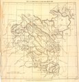
 Shyok River Headwaters System 1923.png 1,280 × 760; 1.85 MB

.jpg)

,_cropped.jpg)
.jpg)

.jpg)


